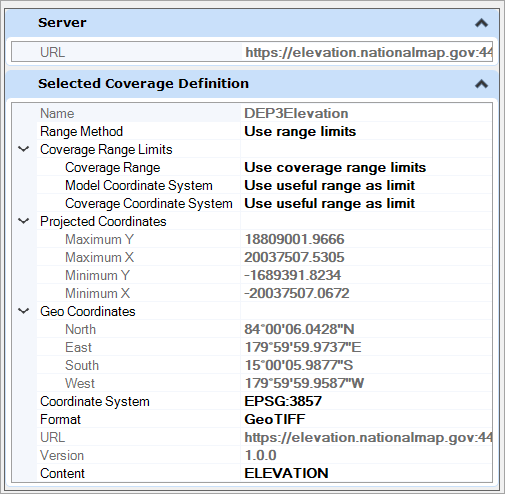
WCS Coverage Editor - Selected Coverage Definition
| Setting | Description |
|---|---|
| Name | Displays the name of the selected coverage definition |
| Range Method |
Use to set the range limits to use for the coverage definition. Range Method may be "Use range limits" or "Manual ." If "Use range limits" is selected, the Coverage Editor uses the constraints specified in Coverage Range Limits ,and all the coordinates are read-only. If"Manual" is chosen, you can manually enter the coordinate values. |
| Coverage Range Limits |
The coverage editor generates the coordinates by taking the intersection of the C overage Ranges, the useful range of the Model Coordinate System, and the useful range of the Coverage Coordinate System, ignoring any component marked "Do not use as the limit ." Choices for Coverage Ranges are: Choices for Model Coordinate System and Coverage Coordinate System are: |
| Projected Coordinates | Displays the Projected Coordinates of the selected coverage definition. |
| Geo Coordinates | Displays the Geo coordinates of the selected coverage definition. |
| Coordinate System | Displays the active coordinate system selected. You can change the coordinate system using select coordinate system dialog. |
| Format | Indicates the format type of the selected coverage definition. |
| URL | Displays the selected WCS URL address. |
| Version | Displays the WCS server. |
| Content | You can set the desired content to Elevation or Image. |